
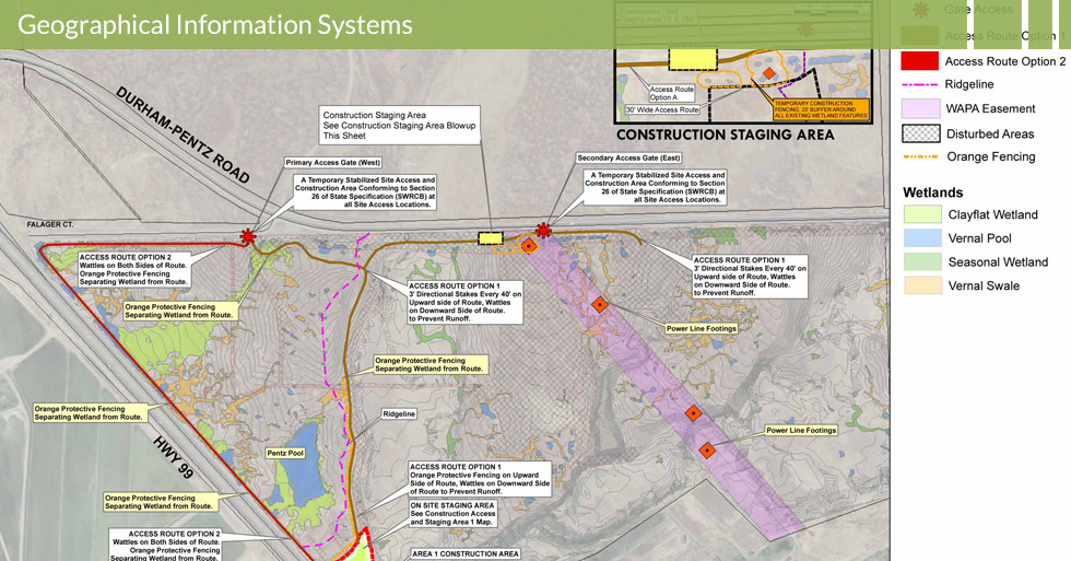
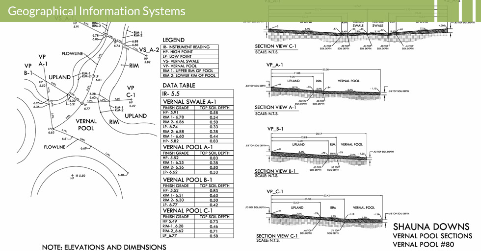
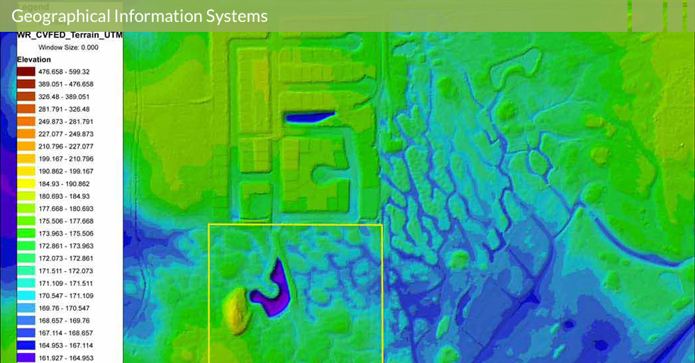
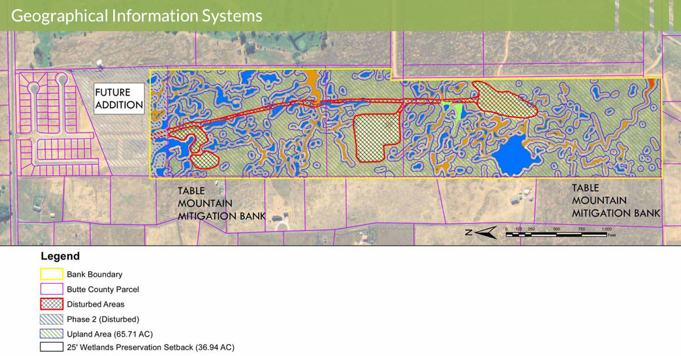
Geographic Information Systems GIS ArcGIS
The Geographical Informational Systems (GIS) Department at Melton Design Group offers experience in utilizing the spatial awareness of our world. We offer services to federal, state, local and private sector clients. Melton Design Group’s expertise in database design and application development is the foundation of our information systems. Mapping and analysis for understanding the world around your project is key in the planning and development of all our projects. Melton Design Group uses state-of-the-art GIS, arc view software, to analyze data and create maps and graphs for your presentation and/or decision making process. MDG services range from mapping and charting of sites and natural resources to aid and development, marketing, defense and intelligence, education, government, health and human services, public safety, transportation and utilities and communications.